Gúdar-Javalambre
Explore the natural beauty of Gúdar-Javalambre by electric bike
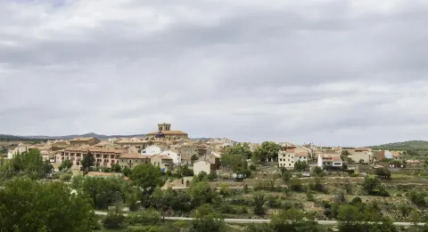
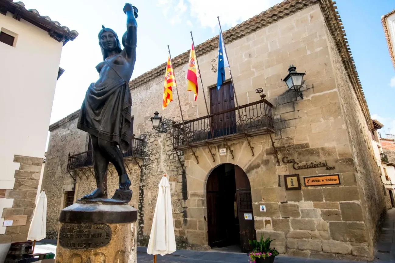
About Gúdar-Javalambre
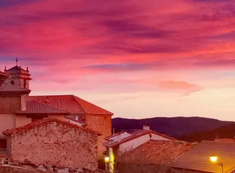
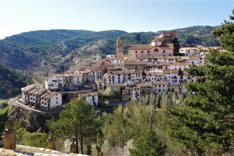
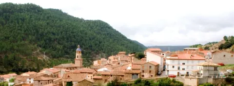
The Gúdar-Javalambre region is a natural paradise in the heart of Teruel, known for its impressive mountainous landscapes, black pine forests and unique starry skies in Europe.
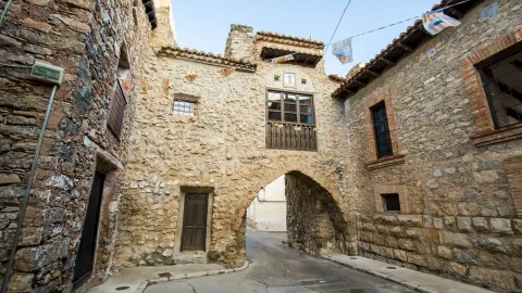
Discover charming villages, traditional architecture and cycling routes that will take you through dreamlike landscapes in one of the most authentic regions of Aragon.
Mapa de la Comarca
24 destinosFeatured routes
Discover the paths that connect these unique destinations.

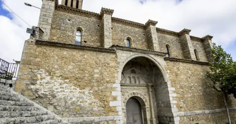
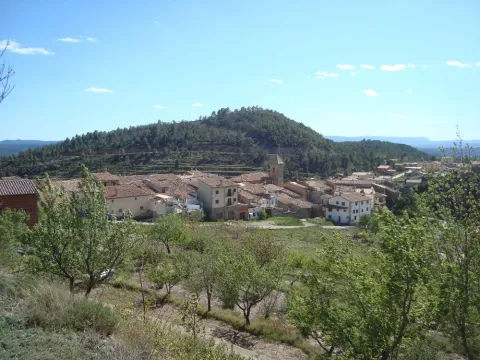
Circular Route Las Minas - Rubielos de Mora
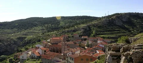
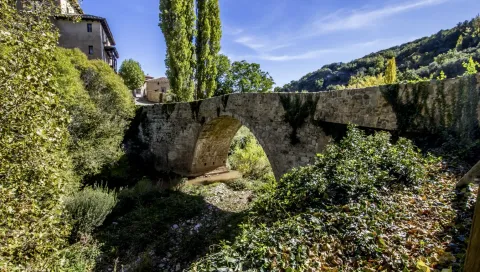
Rubielos de MoraDuring the journey we cover a section of the PR TE 7, another section of the GR160 (Camino del Cid), we cross the Palomarejos river on two occasions, pass by two hermitages (San Antonio and Los Mártires), numerous farmhouses, pens, medieval bridges and visit the surroundings of Las Minas. The route is easy to follow, with no major elevation changes, although it tends to rise in the first section (upon leaving the village) and in the last section that leads us to Las Minas. It is highly recommended to bring some food and plenty of drink, especially in the summer months.
We leave the Town Hall heading southwest, towards the Neighborhood of the Virgin of Carmen. Upon reaching the neighborhood of the Cubes, we turn right, following the PR TE 7. After 2 kilometers we reach the Alto de la Venta, the highest point of the route (1,015 m), from where we can enjoy panoramic views of the entire area. From here, the descent to the medieval bridge (5 km from the start) begins, where, a few meters before, we will turn left to climb to the site of Las Minas.
In this mining complex from the early 20th century, bituminous slate was extracted, from which, through distillation, oils used in chemical products and fuels were obtained. It is worth exploring the area and climbing to the base of the main chimney, from where the rest of the complex can be seen. Next to the Mines there is a youth camp, which usually hosts groups of young people during the summer.
Once the visit is over, we go back the same way to the medieval bridge, from where we start the return journey to Rubielos, crossing the A 1515 road and passing by the Hermitage of Los Mártires, during the section of the Camino del Cid. In the final stretch of the route, we will pass through several paved sections, where we must take extra precautions, especially when following the A232, which connects Rubielos de Mora with Mora de Rubielos.
Another route to enjoy nature and the constructions found along the way. Don't forget your camera!

High Matanzas Route
Rubielos de MoraThis circular route of 20.5 km traverses some of the most tranquil and natural surroundings of Rubielos de Mora. After leaving the historic center, the itinerary enters forest tracks surrounded by pine and juniper, progressively ascending towards the Alto Matanzas, where wide views of the plateau can be obtained.
Subsequently, the route descends towards the area of Hoya Marín and the site of Piedras Gordas, an environment characterized by rock formations, small ravines, and Mediterranean vegetation. The route combines comfortable paths with wide tracks and allows for enjoying a varied landscape without major technical difficulties.
With 432 m of positive elevation gain, it is an accessible and very complete excursion, ideal for getting to know the natural surroundings of Rubielos de Mora.
Types of Path
- Trail: 13.6 km
- National road: 4.45 km
- Other routes: 1.73 km
- Street: 829 m
- Narrow path: 556 m
- Road: < 100 m

Balagueras Reservoir Route
Rubielos de MoraLa Ruta 5 del Embalse de Balagueras es un recorrido de carácter paisajístico que atraviesa algunos de los relieves más singulares de la zona sur de Rubielos de Mora. El itinerario combina pistas forestales, senderos entre sabinas y laderas abiertas, y tramos que se aproximan a los cortados calizos que dominan la cuenca del antiguo embalse de Balagueras.
A medida que se avanza, el terreno asciende suavemente hasta alcanzar zonas elevadas desde donde se obtienen amplias panorámicas de los farallones y del paisaje quebrado característico de esta parte de la sierra. Uno de los puntos más destacados es el Mirador del Pantano de Balagueras, una plataforma natural sobre el escarpe que ofrece vistas espectaculares del valle y de las paredes rocosas que lo rodean.
El regreso discurre entre pinares y sabinares, atravesando un entorno tranquilo y de fuerte carácter natural, ideal para disfrutar del silencio y de la geología tan marcada de Gúdar-Javalambre.
Ruta muy recomendable para quienes buscan paisajes amplios, relieve escarpado y miradores naturales sin dificultad técnica elevada.
Tipos de camino:
- Senda: 14,2 km
- Carretera nacional: 3,70 km
- Calle: 3,15 km
- Carretera: 669 m

Scenic Viewpoint Route - Rubielos de Moral
Rubielos de MoraThe route to the Mirador de la Jornada is a medium mountain trail that ascends from the surroundings of Rubielos de Mora to one of the most panoramic natural balconies of the municipality. The itinerary combines forest tracks and traditional paths, advancing through pine forests, open slopes, and areas of Mediterranean scrub.
The ascent is gradual and constant, reaching heights close to 1,280 m above sea level, allowing for wide views over the valley, the historic center of Rubielos, and the mountains that close the horizon. The Mirador de la Jornada stands out for offering a clear and elevated perspective, ideal for observing the transition between the plain and the reliefs of Gúdar. After reaching the summit, the route continues over gentle terrain, with sections of comfortable track that facilitate a pleasant return. The surroundings maintain the genuine character of the region: silence, well-preserved nature, and a landscape that mixes forest and open areas.
An ideal route for those seeking spectacular views, tranquil nature, and a varied itinerary without high technical difficulty.
Types of path:
- Path: 13.4 km
- Road: 3.06 km
- National road: 2.51 km
- Street: 2.08 km

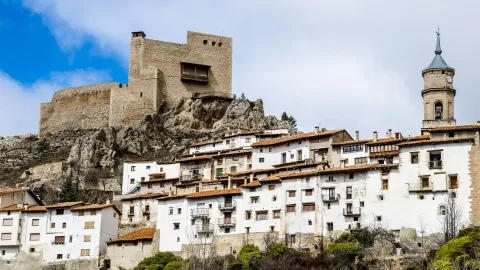
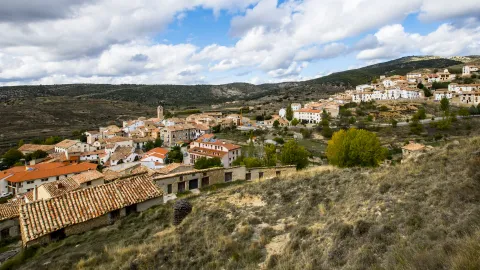
Rubielos Route - Santa María's Peñas Viewpoint - Rubielos
Rubielos de MoraThis route traverses the natural and heritage environment of Rubielos de Mora, combining urban sections of the historic center with open areas of path and track. From the bike station, the route enters through the Portal de San Antonio and skirts the urban core to connect with gentle and accessible trails. The itinerary crosses areas of cultivation, small hills, and characteristic corners such as the Peirón, one of the traditional elements of the Teruel rural landscape. It is a comfortable, varied route with beautiful views of the profile of Rubielos, ideal for enjoying on an e-bike without technical difficulty.
Types of path:
- Trail: 12.0 km
- Street: 1.93 km
- Road: 1.82 km
- Other paths: 738 m

Ruta Rubielos de Mora - Mirador de la Atalaya - Rubielos de Mora
Rubielos de MoraEsta ruta circular desde Rubielos de Mora te sumerge en algunos de los parajes más singulares y menos transitados de la comarca Gúdar-Javalambre. El recorrido combina pista forestal, senderos tradicionales y zonas abiertas de alto valor paisajístico, ofreciendo una experiencia ideal tanto para senderistas como para ciclistas de montaña con buena condición física.
El itinerario asciende progresivamente hacia la Peñuela, una zona elevada que ofrece magníficas vistas sobre el entorno boscoso y los relieves suaves típicos de la sierra. Desde aquí, el trazado se adentra en las Hoces, un tramo mucho más escénico donde el paisaje se encañona ligeramente y aparecen formaciones rocosas, pequeños cortados y vegetación de ribera en los puntos más umbríos.
La segunda parte del recorrido conduce hacia el Alto de la Venta, punto panorámico que permite contemplar buena parte del término municipal de Rubielos de Mora, así como las alineaciones montañosas que conectan con la Sierra de Gúdar. El descenso, cómodo y progresivo, discurre entre pinares abiertos y antiguas vías pecuarias antes de regresar al municipio.
Es una ruta muy agradable, variada y perfecta para quienes buscan naturaleza, silencio y vistas amplias sin alejarse demasiado del casco histórico de Rubielos de Mora, uno de los pueblos más bonitos de España.
Tipos de camino:
- Senda: 16,5 km
- Carretera: 3,65 km
- Calle: 1,36 km
- Carretera nacional: 181 m

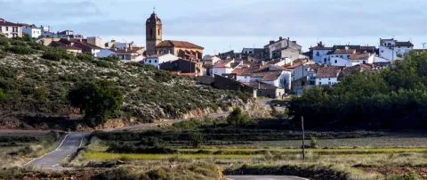
Albentosa Route - Los Toranes
AlbentosaThis circular route from Albentosa combines rural roads, trails, and sections of Mediterranean landscape with holm oaks, kermes oaks, and open views over the valley.
The route allows access to the area where the Mijares River has carved vertical walls, pools, and rock formations that give character to the ravine. From several points along the itinerary, panoramic views of the surroundings can be enjoyed, a natural spectacle especially beautiful during times of high flow.
The return to Albentosa is made via gentle and comfortable tracks, completing a varied, natural, and highly scenic route, ideal for hikers and cyclists looking for an experience close to the village but with spectacular views.
Types of path:
- Trail: 14.6 km
- Road: 4.03 km
- Street: 1.75 km
- Other routes: 100 m

Albentosa Route - Enduro
AlbentosaThis short but intense route traverses some of the most technical and fun sections of the surroundings of Albentosa. After leaving the urban area, the itinerary delves into the oak grove of the Sazadilla ravine, a shady and very attractive place where narrow paths and quick descents are linked together.
The route includes two highlighted descents, fluid and with rocky sections, that coincide with part of the official course of the Albentosa Mountain Race. These sectors are ideal for those seeking a more technical and enduro-style experience.
Although the distance is short, the combination of slopes, natural paths, and irregular terrain sections makes the route present a high difficulty and require good handling technique.
It is a perfect route for cyclists looking for adrenaline, varied terrain, and a beautiful natural environment in the heart of Albentosa.
Types of path:
- Other paths: 3.86 km
- Narrow path: 3.03 km
- Road: 2.65 km
- Street: 344 m